
Built for Public Works Requirements.
Rasters is an operations-first software platform designed for public works teams, with a focus on snow & ice control and waste collection.
20+
Years of innovation in
mapping & navigation.
100+
Cities using Rasters today.
100K+
Field activities to date.

Logistics-Level Expectations.
Public-Sector Reality.
Routes live in binders, PDFs, and the heads of your most experienced operators. New and seasonal crews take weeks to reach standard — if they ever do. Supervisors rely on spot checks, radio calls, and after-the-fact reporting.
Seasonal onboarding adds up fast
3–5 weeks per operator makes turnover one of your biggest recurring costs.
Missed segments are expensive
Re-runs, overtime, and resident complaints add up — every storm, every season.
Supervisors are managing blind
10–30 minutes per shift confirming crew locations — weeks of capacity lost to radio calls.
Compliance costs you twice
When an audit hits, assembling records from paper and memory takes hours — every time.

Built for the Operations That Can't Afford to Fail.
Rasters is purpose-built for the public works operations your municipality runs year-round — not repurposed logistics software retrofitted for the field.
Snow & Ice Control
When a Storm Hits, Every Minute Counts.
Snow operations run under intense public scrutiny, tight service levels, and unpredictable conditions. Rasters gives your crews turn-by-turn guidance across every road, alley, sidewalk, and off-road segment — with live updates pushed instantly when conditions change.
Key capabilities:
- Turn-by-turn navigation with operational cues and automatic return-to-route on deviations.
- Multi-lane pass and U-turn support — built for how plows actually move.
- Anomaly-to-task in seconds — spot an issue before the next pass is done.
- SLA-driven road network with automatic pass logging for compliance reporting.
- Public-facing service portal for live crew and coverage visibility.
Waste Collection
No More Paper Routes. No More Missed Pickups.
Waste collection routes go where standard maps can’t. Rasters handles off-road navigation, missed bin reporting, and live collection status.
Key capabilities:
- Turn-by-turn navigation with operational cues and automatic return-to-route on deviations.
- Off-road routing across alleys, lanes, and private access points.
- Curbside exception reporting — flag service issues instantly, no paperwork.
- Multi-stream route planning for garbage, recycling, and organics in one platform.
Proof of service with GPS, timestamps, and activity tracking for full compliance. - API-ready connectivity with fleet, billing, and citizen platforms.
Designed for the Teams Keeping Operations Running — Every Day.
Policy & Standards Leaders

Stop reconstructing compliance after the fact. Every stop, timestamp, and service record is captured automatically — audit-ready before anyone asks.
Operations Managers

Know what’s done, what’s behind, and what it will cost — before the shift ends. Staff smarter, eliminate re-runs, and make decisions on data instead of assumptions.
Supervisors & Dispatch

Full operational visibility — with on-the-fly changes handled directly by ops. No IT. No GIS. No delays.
Operators in the Field

Built for operators, not IT. Precise turn-by-turn guidance across every road, alley, sidewalk, and off-grid segment — ready on day one, reliable every shift.
Plan
Execute
Monitor
One Connected Workflow.
Rasters unifies planning, in-cab execution, and operational monitoring in a single workflow that works everywhere.
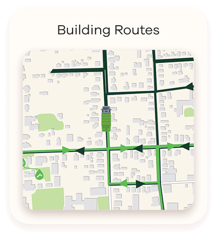
Turn Standards Into Routable Reality
- Build routes from scratch, import shapefiles, or generate from vehicle breadcrumb history
- Support multiple lane passes, U-turns, and fully off-road segments
- Push route and instruction updates instantly to operators in the field
- Sync users and assets from Geotab automatically
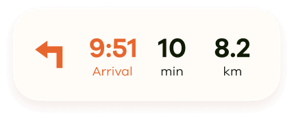

In-Cab Guidance That Levels Up Every Operator
- Precise turn-by-turn navigation across roads, sidewalks, trails, alleys, yards, and off-grid segments
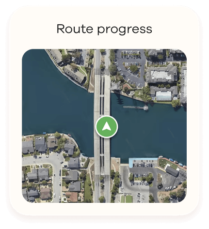
- Resume route progress — operators can pause and return to their exact last recorded point
- Return-to-route recovery and real-time updates
- One tap from the operator.
- Full context for the manager. No calls. No messages.
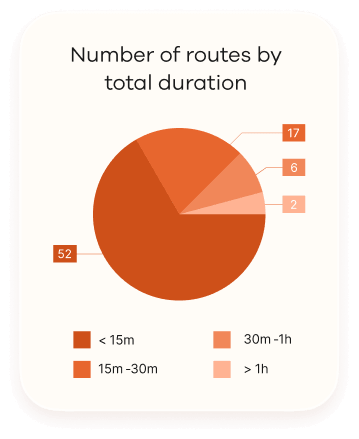
Visibility Without the Administrative Load
- Live dashboards reveal performance, compliance, and bottlenecks
- Anomalies become tasks instantly — no manual follow-up
- Audit-ready records created automatically through digital forms
- Respond to citizen complaints with verifiable completion data
- Public-facing Live Map shows residents real-time service status
- Offline data that syncs automatically when connectivity returns
Plugs Into Your Geotab Telematics.
Rasters extends your existing ecosystem — not replacing it. Deep integrations mean faster deployment, less friction.
- Single sign-on and role-based visibility using your existing Geotab groups
- Automatic vehicle and asset sync from MYGEOTAB
- Access all modules inside MYGEOTAB Add-ins.
- Designed for out-of-the-box value, even with limited IT/GIS resources
Are you a Geotab reseller?
Learn how adding Rasters to your portfolio increases attach rate, strengthens RFP competitiveness, and creates stickier deployments in public works accounts
The Status Quo Has a Price Tag. Calculate Yours.
The inefficiencies are already in your budget. Every shift. Every route. Every season. Our calculator brings them to light.
| Component | Calculation Logic | Annual Savings |
|---|
| Variable | −10% | Base | +10% |
|---|
Notice
The data, assumptions, and results generated by this ROI calculator are provided for illustrative purposes only. They are intended to estimate potential value and savings across different scenarios and organizational personas and should not be interpreted as definitive financial forecasts or guarantees of performance.
This calculator is designed to support internal reflection and discussion by highlighting cross‑functional and often siloed costs that may not be fully visible across business processes. As organizational contexts may vary, results may differ depending on actual use cases, scale, and operating conditions.
This calculator represents an initial version of an evolving model and will be refined over time as additional customer insights and real‑world implementation learnings are incorporated.
This calculator was developed by CDWare and remains its intellectual property.
Frequently Asked Questions.
We already have GPS. Why isn’t that enough?
GPS tells you where your trucks are. Rasters tells operators where to go with turn-by-turn guidance, live coverage tracking, and automatic compliance records. Telematics watches; Rasters leads.
Snow plows, waste trucks, sidewalk units — does it handle all of them?
Yes. Rasters supports snow and ice, waste collection, street sweeping, seasonal maintenance, and other public works services from one dashboard.
Does this need IT or GIS involvement to run?
No. IT and GIS may help during setup, but day-to-day use is built for operations teams. Operators, supervisors, and planners can run the system without technical support.
What’s the cost of going without Rasters?
Manual briefings, phone check-ins, slow onboarding, missed coverage, and hand-built compliance reports add up every shift, every storm, and every season. The ROI Calculator helps estimate what your current process is really costing.
How do I make the business case to leadership?
Start with the costs you already carry: onboarding time, supervisor hours, compliance work, re-runs, fuel, and contractor visibility. The Public Works ROI Calculator turns those inputs into a savings estimate you can bring into a budget conversation.
How long before a new operator can run routes on their own?
One shift. Rasters guides operators through each route with in-cab navigation, including off-road areas, sidewalks, alleys, and service zones they may not know from memory, so they don’t need to memorize routes or shadow veterans first.
Veterans are retiring. How do we protect what they know?
Rasters helps capture route knowledge inside the system: difficult turns, service sequences, compliance checkpoints, and local operating rules. That knowledge stays available for every operator, even when experienced staff leave, so every new operator performs to the standard your most experienced people set.
My team is already at capacity. How does adding something new help?
Rasters reduces the manual work around operations. In-cab guidance cuts routing questions, live dashboards reduce check-ins, and automatic reporting removes much of the documentation work.
We use contractors alongside our own staff. Can Rasters manage both?
Yes. Contractors and internal crews can follow the same route guidance and compliance standards, while supervisors see activity in one operational view. If both fleets use Geotab, coordinated visibility across separate accounts is built in while each organization keeps control of its own data.
We’re already on Geotab. What does getting started look like?
Rasters runs on top of your existing Geotab environment. It is available through the Geotab Marketplace via OrderNow, with no new hardware or separate data migration required.


Your Operation Runs Every Day. We Make Sure It Runs Right.
Whether you’re managing a snowstorm at 3 AM or planning next season’s waste routes, we give your team the tools to operate with confidence, compliance, and full visibility — built on the Geotab platform you already trust.
1260 blvd. Lebourgneuf #315
Quebec city, QC
G2K 2G2, Canada

